By: Sydney Shufelt
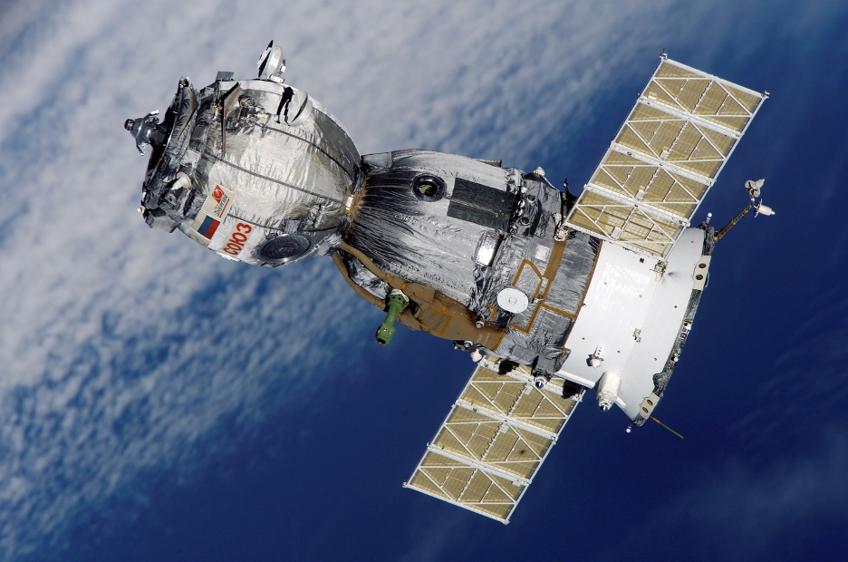
Satellite images are being taken at a higher quality and with more frequency with each passing year. There were only 150 earth observation satellites in orbit in 2008.[1] Now, there are more than 760.[2] With technological advancement, there is a growing concern from privacy advocates that the US government will not be able to continuously regulate satellite imaging and prevent citizens, corporations, and terrorist organizations from accessing data once available only to government spies.[3] When the Outer Space Treaty was first formed fifty years ago, the main guiding principles were those of equality, democracy, and opportunity.[4] Now, governments are left to deal with that which was left unwritten.
The rise of remote sensing[5]and its use by satellites and other unmanned aerial systems (“UAS”) has created a privacy debate regarding the use of technology and the impact it will ultimately have on the constitutional principles of privacy and free speech.[6] The presence of UAS will only increase over time, with hundreds of them navigating airspace with the potential to provide services to farmers, businesses, and homeowners alike.[7] While the benefits of using this technology are numerous, the potential pitfalls of using remote sensing technology for real-time surveillance of privately owned property could have catastrophic consequences.[8]
Currently, commercial satellite imagery can produce images with the ability to spot a car, but not quite determine the make and model.[9] Farmers are able to use these images to track the status of their crops, but the images are not taken frequently enough for them to track the movements of their neighbor.[10] These limitations are deliberately placed on the companies that produce these images through the National Oceanic and Atmospheric Administration (NOAA), the regulatory agency responsible for regulating these activities.[11] The current US federal limit on the resolution of images produced by commercial satellites is 25 centimeters, a figure that was relaxed from 50 centimeters in 2014 to appease consumers.[12] The current limit is likely to come under attack in the near future as international competition continues to put pressure on domestic companies to capture and provide a better resolution to their customers.[13] If NOAA decides it will not budge on the current limit, there is currently nothing in place that could stop a foreign provider from selling their images to consumers in the US.[14]
Commercial remote sensing legislation has been primarily focused on preserving “national security interests, foreign policy and international obligations” according to the U.S. Land Remote Sensing Policy Act of 1992.[15] Later acts such as the 2003 National Security Presidential Directive 27 and the 2006 Licensing of Private Land Remote Sensing Space Systemsfurther demonstrate the complicated balance the government must strike in working to bolster businesses working in the private commercial space, while protecting the interests and obligations of the US.[16] Striking this delicate balance becomes increasingly difficult as satellite companies such as EarthNow explain plans to launch hundreds of satellites that will be capable of providing real-time continuous global video of the Earth.[17] Applying the principles set forth in case law and the current regulation surveillance technology analogous to remote sensing satellites would lead to troublesome outcomes for private citizens.
[1]Tate Ryan-Mosley, Erin Winick & Konstantin Kakaes, The Number of Satellites Orbiting the Earth Could Quintuple in the Next Decade, MIT Technology Review (Jun. 26, 2019), https://www.technologyreview.com/s/613746/satellite-constellations-orbiting-earth-quintuple/.
[2]Christopher Beam, Soon, Satellites will be Able to Watch You Everywhere All the Time, MIT Technology Review(Jun. 26, 2019), https://www.technologyreview.com/s/613748/satellites-threaten-privacy/.
[3]Id.
[4]Licensing of Private Remote Sensing Space Systems, 84 Fed. Reg. 21, 282, (May 14, 2019) (to be codified at 15 C.F.R. pt. 960).
[5]SeeWhat is Remote Sensing?, National Ocean Service https://oceanservice.noaa.gov/facts/remotesensing.html (defining remote sensing as the “science of obtaining information about objects or areas from a distance, typically from aircraft or satellites”).
[6]Kevin Pomfret & Mike Tully, Privacy Issues Raise Concerns for Remote Sensing, (Jan. 22, 2014), https://www.pobonline.com/articles/97204-privacy-issues-raise-concerns-for-remote-sensing.
[7]Id.
[8]Id.
[9]Beam, supranote 2.
[10]Id.
[11]Id.;What is NOAA?, National Oceanic and Atmospheric Administration(Feb. 2011), https://www.legislative.noaa.gov/policybriefs/What%20is%20NOAA%202011%20-%20FINAL.pdf.
[12] SeeBeam, supranote 2 (stating that “investors can predict oil supply from the shadows cast inside oil storage tanks. Farmers can monitor flooding to protect their crops. Human rights organizations have tracked the flows of refugees from Myanmar and Syria”).
[13]Id.
[14]Id.
[15]U.S. Land Remote Sensing Policy Act of 1992, H.R.6133.
[16]2003 National Security Presidential Directive 27; 2006 Licensing of Private Land Remote Sensing Space Systems.
[17]Kevin Pomfret and Mike Tully, Privacy Issues Raise Concerns for Remote Sensing, (Jan. 22nd, 2014) https://www.pobonline.com/articles/97204-privacy-issues-raise-concerns-for-remote-sensing.